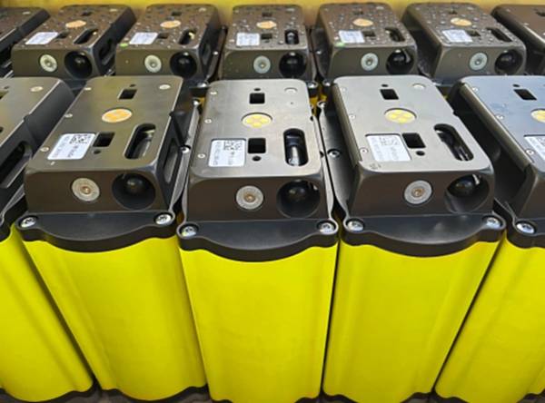
Marine geophysical services company PXGEO has signed two significant contracts with Petrobras-led consortia, to deliver seismic data acquisition and monitoring services in the Santos Basin, offshore Brazil.The projects will run consecutively in 2026 with PXGEO deploying its proprietary MNode 4C ocean bottom node (OBN) technology as part of the scope.The company’s MNode technology delivers a 300-day battery life…
Sonardyne will provide passive seismic monitoring services for the Northern Endurance Partnership (NEP) at the Endurance carbon storage site in the U.K. North Sea, expanding its role at the country’s first carbon capture and storage (CCS) project…
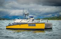
Geodetic Offshore Services Limited (GOSL) has acquired REAV-47 uncrewed surface vessel (USV) from HydroSurv, which will be used for hydrographic and geophysical survey operations in Nigeria.The sale marks the HydroSurv’s first delivery to Nigeria…
TDI-Brooks reportst that it 'effectively and safely' carried out a third-party geotechnical coring project for Geohidra. This operation was conducted from the DRAGON Field to the HIBISCUS platform off the coast of Venezuela and Trinidad aboard the DONA JOSE II (DJII)…
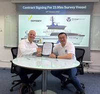
Singaporean shipbuilder Strategic Marine has signed a shipbuilding contract with Odyssey Group for a multi-purpose survey vessel, which will operated offshore Australia.Under the terms of the agreement, Strategic Marine will construct the advanced…
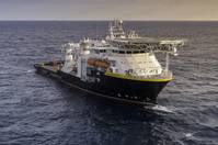
U.S.-based subsea services and technology firm Oceaneering has placed an initial order for a minimum of 100 units of Exail’s new Octans 9 Attitude Heading Referencing Systems (AHRS), as it aims to enhance capabilities for offshore survey and positioning projects…
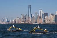
Irish ocean data company XOCEAN has secured $118.3 million investment to support its expansion across multiple offshore segments including wind development and operations, asset integrity assurance, CCUS, and civil hydrography.XOCEAN partnered with S2G Ventures to structure the round…
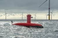
The Shom (French Naval Hydrographic and Oceanographic Service) has confirmed the acquisition of the DriX H-8 surface hydrographic drone, developed by the French robotics and maritime technologies specialist Exail.The acquisition marks a strategic…
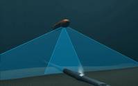
Autonomous Underwater Vehicles (AUV’s) have been introduced as efficient tools for subsea pipeline inspections. It has also been demonstrated that AUVs can be used to perform contactless and continuous electric field measurements of the Cathodic Protection (CP) systems along pipelines…
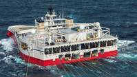
Energy data and intelligence firm TGS has secured a baseline 4D streamer contract in the Southern Atlantic region with an independent energy company.The contract spans approximately 90 days, according to TGS.TGS will leveraging the capabilities of the Ramform acquisition platform…
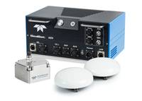
Teledyne Marine introduces the Intrepid, a GNSS/Inertial Navigation System. The system is integrated with the SeaBat T20-ASV processor and comprises a compact inertial measurement unit (IMU) and two GNSS antennas, delivering reliable and precise positioning…
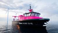
Beam, a company created by the recent merger of Rovco and Vaarst, has strengthened its fleet with two new autonomous surface vessels (ASVs), called Xplorers, and a Quantum EV workclass remotely operated vehicle (ROV).The Quantum EV and Xplorer vessels…
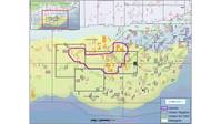
Viridien has announced the start of the Laconia 3D OBN multi-client seismic program in the US Gulf of Mexico.Covering 330 offshore continental shelf (OCS) blocks in the Garden Banks and Keathley Canyon protraction areas, the project is supported by industry funding…

Geospatial cloud specialist north.io has been awarded a €2.4 million grant for the 'Argus' project for underwater big data analytics in the context of critical underwater infrastructure, marking the highest single funding the Kiel-based company has ever received…

Terradepth and Hypack announced a strategic partnership designed to enable surveyors to run Hypack's software directly in the cloud through Terradepth's Absolute Ocean platform.By integrating Hypack software with Terradepth's cloud-native Absolute Ocean platform…
