A developer of real-time 3D sonar technology and real-time subsea intelligence has launched a new product that uses artificial intelligence (AI) to automatically detect and recognize distinct underwater objects.Coda Octopus announced Tuesday…
Norwegian seismic surveyor SeaBird Exploration said it had taken delivery of the Geowave Voyager from France's CGG, and the vessel has been renamed Eagle Explorer.The vessel was acquired fully rigged with 40km streamer and dual source, for $17 million and a NOK 120 million private placement…
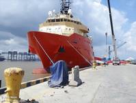
Geosciences company Benthic completed field work for Esso Exploration and Production Guyana Ltd. for an offshore geotechnical investigation and environmental baseline survey in the Stabroeck and Canje blocks offshore Guyana.Benthic said it executed…
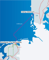
A subsea power line set to link the networks of Denmark and the Netherlands reached the Dutch coast on Friday as part of plans to share excess electricity from wind farms and other sources.The 325 km (202 mile) long COBRAcable, short for Copenhagen…
The fast-track 3D seismic data from CGG’s recent Mozambique multi-client survey in the outer Zambezi Delta Basin is now available for license, the geoscience company announced during Africa Oil Week.The data covers a 15,400 km2 area over blocks Z5-C and Z5-D and surrounding open acreage…
The UK Hydrographic Office (UKHO) has been awarded Highly Commended at the STEM Inspiration Awards, in recognition of their outstanding commitment to encouraging young people into science, technology, engineering and mathematics careers.According to a press statement…
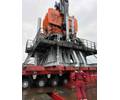
Hydrographic and geophysical survey company Ocean Infinity has placed three separate orders for a total of five Kongsberg Maritime HUGIN autonomous underwater vehicle (AUV) Systems, increasing its inventory to 15.Kongsberg Maritime said the…
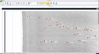
Survey and positioning services provider iSURVEY said it has completed a 30-day geophysical seabed survey for offshore pipelay and subsea construction company Allseas.The project team set out to identify obstructions and hazardous seabed features…

Teledyne CARIS has released Bathy DataBASE 5.2, which introduces enhanced tools for validating and creating chart features from lidar surveys as well as new bathymetry compilation techniques.This latest version includes an updated workflow process…
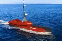
Fugro has signed a joint development agreement with autonomous vessel technology firm L3 ASV to create the next generation of autonomous vessels for the commercial survey market.The partnership brings together the expertise of both companies…
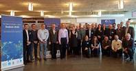
The first regional mapping meeting for The Nippon Foundation-GEBCO Seabed 2030 Project has been held in Stockholm, covering the Arctic, Antarctic and North Pacific regions. The meeting, held last month, brought together ocean mapping experts…
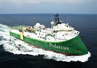
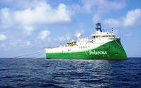
Offshore geophysical firm Polarcus Limited said Thursday it has received an award for a 3D marine seismic acquisition project in West Africa.The award comprises two surveys of approximately three months each, with the first survey expected to commence Q2 2019 and the second survey Q4 2019.

Oslo-listed seismic surveyor TGS fell more than 10 percent after reporting disappointing third-quarter results on Thursday, as oil firms were still too cautious to spend despite a raft of upbeat earnings.TGS, which maps the seabed in search of hydrocarbon deposits for oil firms…
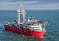
Dutch deep-sea prospector Fugro has reported a 29.1 percent rise in third-quarter revenue on a comparable basis, driven by the expansion of offshore wind developments and a recovery in the global oil and gas market.Rising oil prices have helped…
Marine geophysical company Polarcus Limited said it has been awarded a 3D marine seismic acquisition project in South East Asia.The project duration is approximately four months and is scheduled to commence in Q4 2018.Following this award, the Polarcus fleet is 100 percent booked for Q4 2018.
 Subscribe