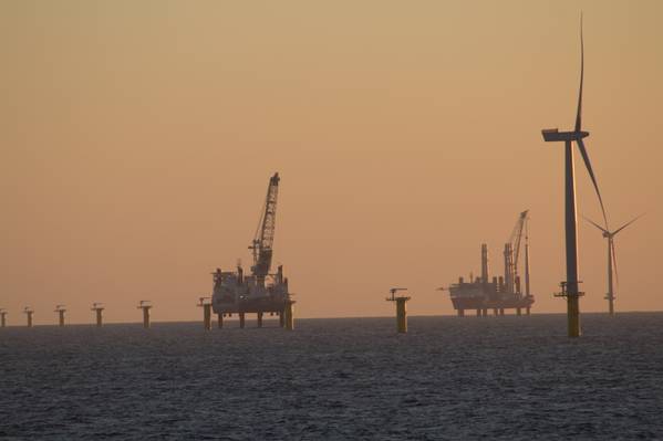
For any country blessed with easy access to the shallow and windy North Sea, offshore wind will be key to meeting net zero targets. Developing these wind farms is partly a challenge for engineers, but it but also depends on the geology beneath the seabed – and that’s where geoscientists like us come in. As the industry collects more data, the seabed geology is proving to be far more complicated, and revealing, than previously envisaged.
Over the past few million years of on-off ice ages, large ice sheets advanced and retreated over northern Europe many times. This altered the landscape and drove changes in the sea level. The UK’s current coastlines provide a snapshot of this changing landscape, but submerged under the sea is a far more complete archive of recent Earth history.
For instance, the Dogger Bank, a shallow region of the central North Sea with lots of potential for wind power, was dry land until just 8,000 or so years ago. Fishing vessels occasionally drag up prehistoric tools and artefacts from the people who lived there. We now know much more about these cycles of ice advance and retreat thanks to huge areas of the North Sea being surveyed for offshore windfarm development.

We are geoscientists who map these layers of sediment below the seabed. Each layer can tell us something about the world at the time it was deposited. Some layers are glacial sediments, bulldozed by the movement and pressure of the overlying ice, and in some places glacial lakes that formed from water melting from the ice sheets. Other layers show that once the ice retreated, terrestrial landscapes formed with complicated networks of river channels that meandered through woods and peatlands.
As ice sheets melted towards the end of each ice age, rising seas flooded the landscape. We know this because sands and silts deposited during these warm periods contain seashells. This cycle of destruction as the ice advances, and repair as it retreats and the land was flooded, has resulted in a complicated arrangement of sedimentary layers.

By studying these past environments in detail, we can better understand how landscapes evolve in response to changes in climate. Research of this nature has been conducted onshore for centuries, but there the geological record is frustratingly fragmented by erosion and the imprint of human development. By comparison, offshore we can trace the transition from ice ages to warm landscapes across tens or hundreds of kilometers, in part thanks to the unprecedented detail of data collected to support offshore wind.
In the North Sea, this has revealed that multiple cold-warm cycles have left different deposits under changing climates and sea levels. These complicated ground conditions can make the installation of wind turbines and interconnecting cables highly problematic since different types of sediment provide different challenges.
While stiff glacial clays often provide strong foundations for turbines, coarse marine sands are easy to erode from around the base towers and can lead to instability. The peat that formed during warm climates, before the sea-level rise, poses particular challenges as its fibrous nature makes it hard to dig trenches and reduces the efficiency of the cables transferring energy onshore.
Detailed mapping of the seabed, at a resolution never before possible or even considered, allows the offshore wind industry to plan more efficient and bespoke installations at each windfarm site. And since the sea level fell by 100 metres or more during each ice age, many other submerged continental shelves currently earmarked for offshore development will have been exposed at one time or another. This changing landscape during the past few million years will have resulted in varied and complex layers of sediment at potential offshore windfarm sites around the world, whether near to or far away from former ice sheets. ![]()
Authors
Natasha Barlow, Associate Professor of Quaternary Environmental Change, University of Leeds and David Hodgson, Professor of Sedimentology and Stratigraphy, University of Leeds
This article is republished from The Conversation under a Creative Commons license. Read the original article.